Today we are going to have a
look at altitudes that will come in handy when flying, planning IFR flights and interviews (these can be
asked quite a bit)
So let’s jump straight into
it.
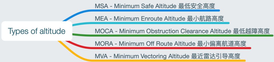
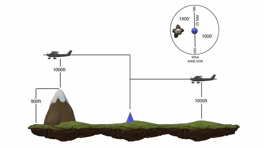
MSA is the minimum safe altitude
within a 25 nm (Nautical Mile) radius of a navigational aid. MSA will give you 1000 ft separation from the
highest terrain within that sector. We normally see the MSA on our Approach plates for runways.
Can we descend below MSA? Yes,
provided we are under radar control and we still remain above the radar altitudes. (Remember it is still
your responsibility to make sure you don’t fly into terrain!)
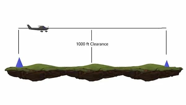
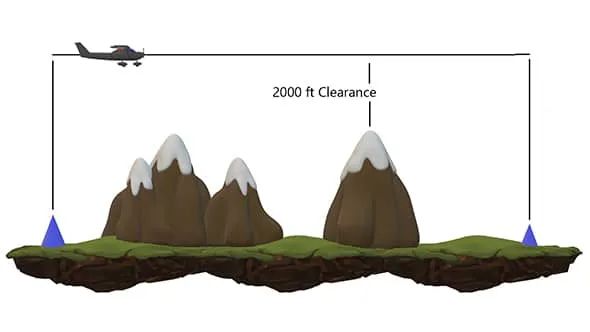
MEA is the minimum altitude that will guarantee signal of navigation aids along the route, give you two-way communication with ATC and provide obstacle clearance. MEA will give you 1000 ft separation from terrain in non-mountainous areas and 2000 ft separation in mountainous areas. (Mountainous area is when a terrain change of more than 3000 ft is experienced within 10 nm)
You can get MEA on IFR Charts following by:
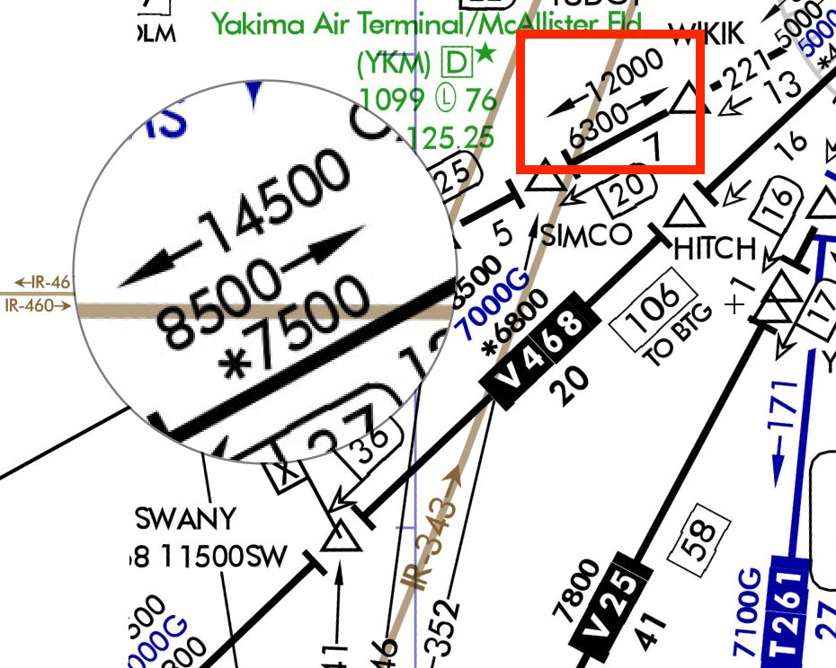
无线电定位点之间的最低高度,通常标在航路代号框的上方或下方,如"←10000 8000→", "←6500","→9900",箭头表示飞行方向。
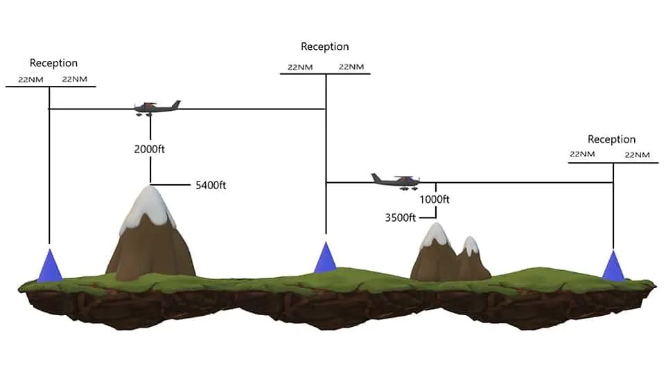
MOCA will give you a minimum altitude above terrain
and guarantee VOR reception within 22 nm from the beacon. MOCA will give you 1000 ft separation from
terrain when the terrain is less than 5001 ft and 2000 ft separation when the terrain is more than 5000
ft.
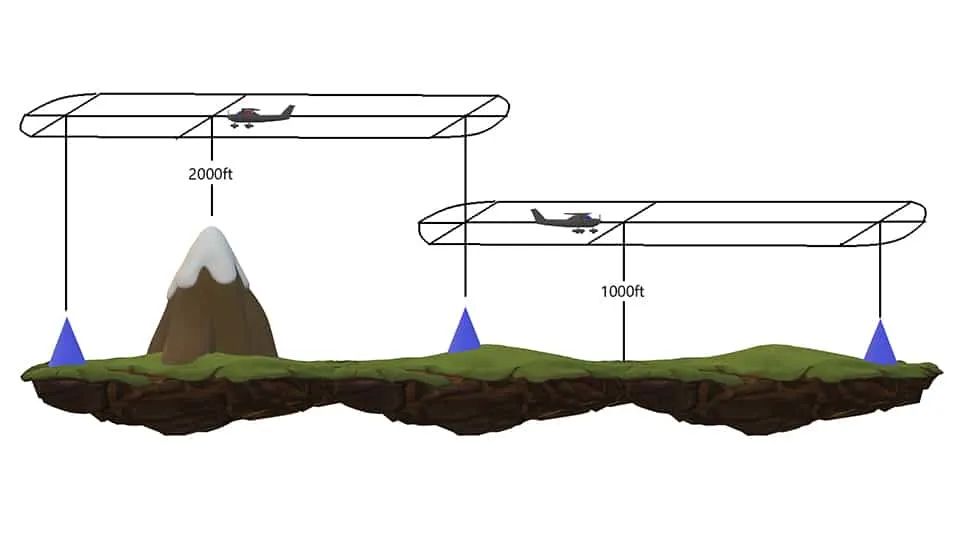
MORA will give you separation from terrain up to 10 nm off the route center line and 10 nm radius around the ends of the route. MORA will give you 1000 ft separation from terrain in non-mountainous areas and 2000 ft separation in mountainous areas.
Reference:
[1]MSA, MEA, MOCA, MORA, MVA. What are they? - SA Bush Pilot. (n.d.). Retrieved February 29, 2020, from http://sabushpilot.com/msa-mea-moca-mora-mva-what-are-they/
· END ·